
Services

Smarter Farming From the Sky
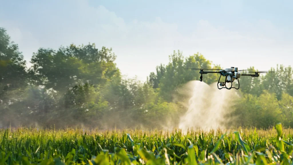
Drone Spraying & Spreading Services
At Aerial Ag Australia, we use advanced spray and spread drones to deliver precision agriculture solutions that save you time, reduce costs, and improve results across your farm. Whether it’s herbicide, fungicide, fertiliser, or seed—we apply it fast, efficiently, and exactly where it’s needed.
Drone Spraying
Our drones are equipped with state-of-the-art GPS and spray control systems to deliver targeted and uniform applications over a wide range of terrain.
We spray:
- Broadacre crops – pre and post-emergent herbicides
- Fungicides and insecticides
- Fencelines, channels, laneways and headlands
- Blackberries and woody weeds in steep country
- Spot spraying in hard-to-reach or sensitive areas
Benefits of Drone Spraying:
- No crop damage or soil compaction
- Access to wet, sloped, or rough ground
- Reduced chemical use with precision application
- Ideal for patchy, small, or irregular paddocks

Drone Spreading
From small seeds to granular fertiliser, our drones offer fast and accurate broadcast spreading for a range of products.
Perfect for:
- Cover crops and pasture seed
- Granular fertilisers or soil amendments
- Sloped or inaccessible country
- Top-up zones or missed areas from machinery
Why Use Drone Spreading?
- Great for wet paddocks or steep terrain
- Even coverage without wheel tracks or machinery delays
- Reduce fuel and labour costs
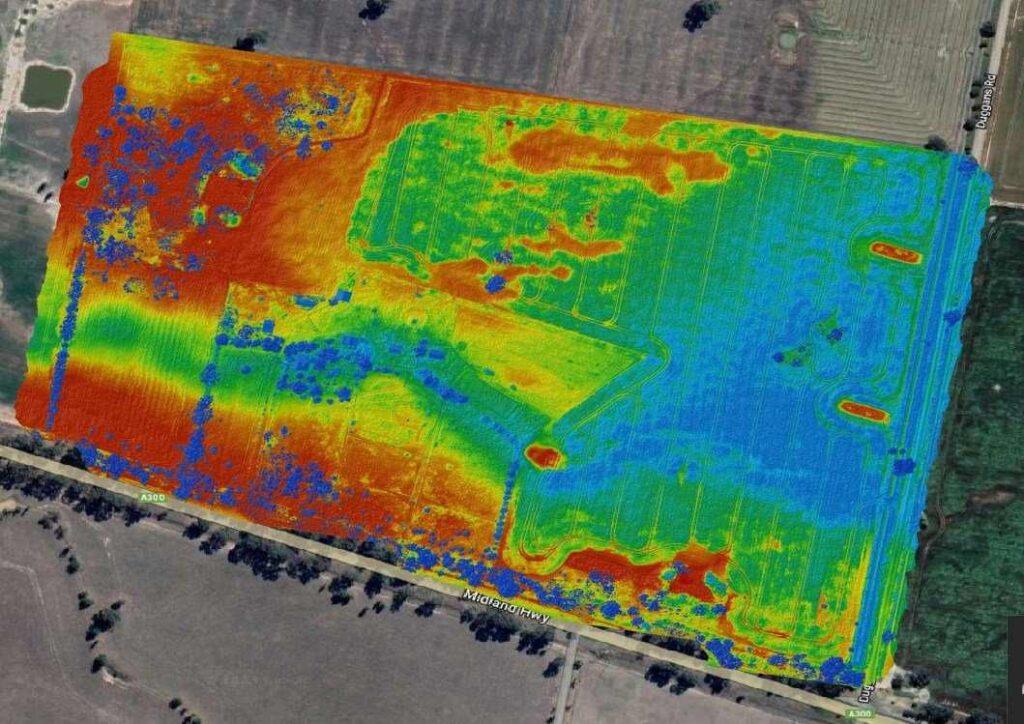
Drone Mapping Services
See your land like never before.
At Aerial Ag Australia, our drone mapping services give you powerful insights from the sky. Using high-resolution cameras and advanced sensors, we provide fast, accurate maps to help you make smarter decisions in the paddock.
Weed Identification
Spot weed outbreaks early with high-resolution aerial imagery. Our drone maps clearly highlight problem areas, making it easy to plan targeted spraying—saving time, money, and chemicals.
Topographical Mapping
Understand the lay of your land with precise elevation data. Our drones generate detailed topographic maps perfect for drainage planning, earthworks, paddock layout, and irrigation system design.
3D Modelling
Get full 3D models of your property, ideal for visualising terrain, measuring stockpiles, or planning developments. These models provide an interactive way to assess slopes, valleys, and surface features.
Fast. Accurate. Affordable.
- High-resolution orthomosaic maps
- NDVI and multispectral options
- Quick turnaround with digital delivery
Why Farmers Choose Aerial Ag
- Local, experienced, and fully licensed operators
- Fast job turnaround and reliable service
- Digital job records and GPS mapping included
- Serving Victoria and Southern NSW